Little Lakes Valley
distance 6.5 miles
time 4-5 hours
difficulty moderate
date july 5, 2019
trailhead elevation 10,200’
elevation gain 800’
notes the main parking lot fills up by mid morning so plan to arrive early, there’s overflow parking about .5 mile down the road. restrooms are located at the trailhead
warning very high elevation that requires acclimation

I need to start by saying, wow this is one of the most scenic hikes I’ve been on. With alpine lakes, snowcapped peaks, dozens of streams flowing into waterfalls, and breathtaking vistas around every turn, Little Lakes Valley feels straight out of a dream that you don’t want to wake up from. The light headed dizziness from the altitude, and the otherworldly contradictions only seem to enhance the dreamlike state…
Where the thin crisp air tightens its grip around your head and chest, as if trying to squeeze the breath out of your lungs, while the sun warms your back and shoulders comforting you with each step, like a familiar whisper gently encouraging you to carry on and discover what lies around the next bend,
Where the most tiny delicate flowers you’ve ever seen grow in bright clusters from the shadows of jagged cracks torn into ancient metamorphic granite,
Where you can reach out and hold impossibly enormous mountains right in the palm of your hand, through perfect reflections on the serene surface of alpine lakes,
Where the dull roar of thundering waterfalls echoes deep through the valley, while birds rehearse their harmonic melodies in the tree tops,
Where a light breeze collects infinite layers of fragrance from mountain passes, through dense forests, and along open meadows on a journey to wrap you in its ribbons of perfume,
Where imposing rocky peaks seem to have existed since beginningless time and will continue to stand fearless into eternity…

The parking area and trailhead are located just over 10,000’ elevation, so you’re in the heart of the High Sierra the moment you step out of the car. This is the perfect day hike if you want to fully experience the sensory magic of the Range of Light but aren’t prepared for major elevation gains or overnight backpacking.
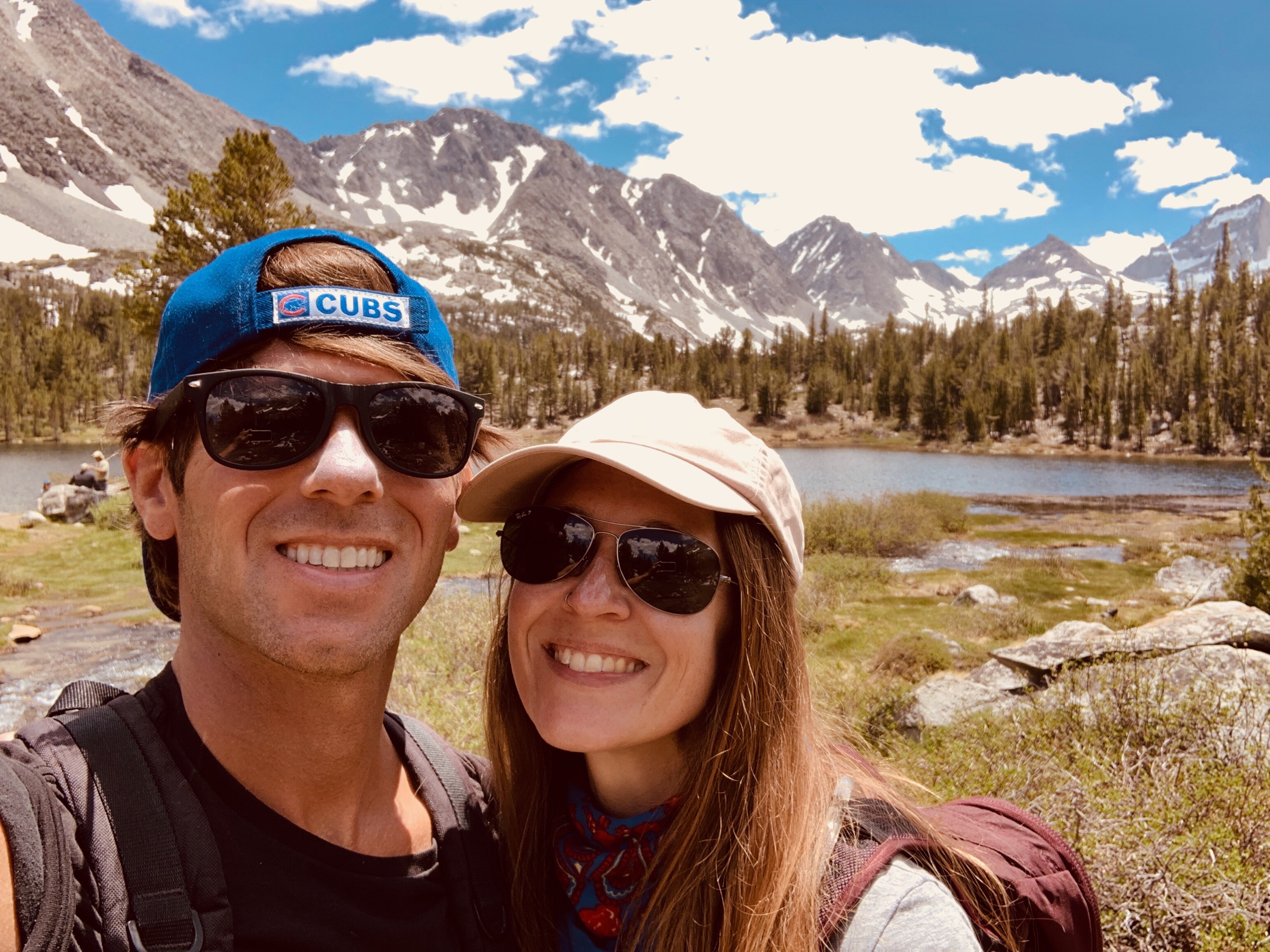
We reached the trailhead just before 9am and the main lot was already near capacity. By this time the sun had risen well into the sky, so even though the air was still cool we ditched our sweatshirts and layered up on spf instead. The mosquitos must have gotten an invitation to the party (it’s called Mosquito Flats Trailhead after all), so don’t forget to bring the bug spray. With our packs full of water and snacks, we headed to the trail.

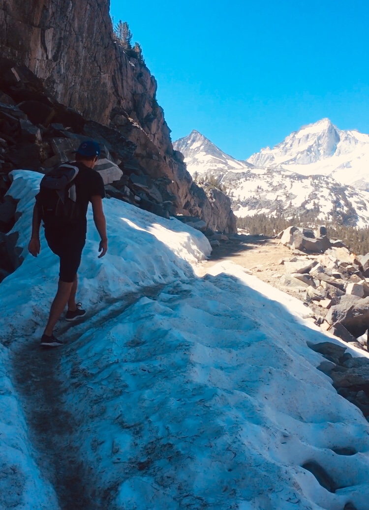
The trailhead is located just beyond the restrooms to the right of Rock Creek. There’s only a gradual incline on the clearly marked rocky path, but the altitude hits fast and hard. Make sure to stay hydrated and take plenty of rest stops along the way, not just to catch your breath but to allow your senses to take everything in.
After .5 miles of following along side the creek we came to a junction, keep left toward Morgan Pass to stay in Little Lakes Valley. Heading right will go to Mono Pass and Ruby Lake.
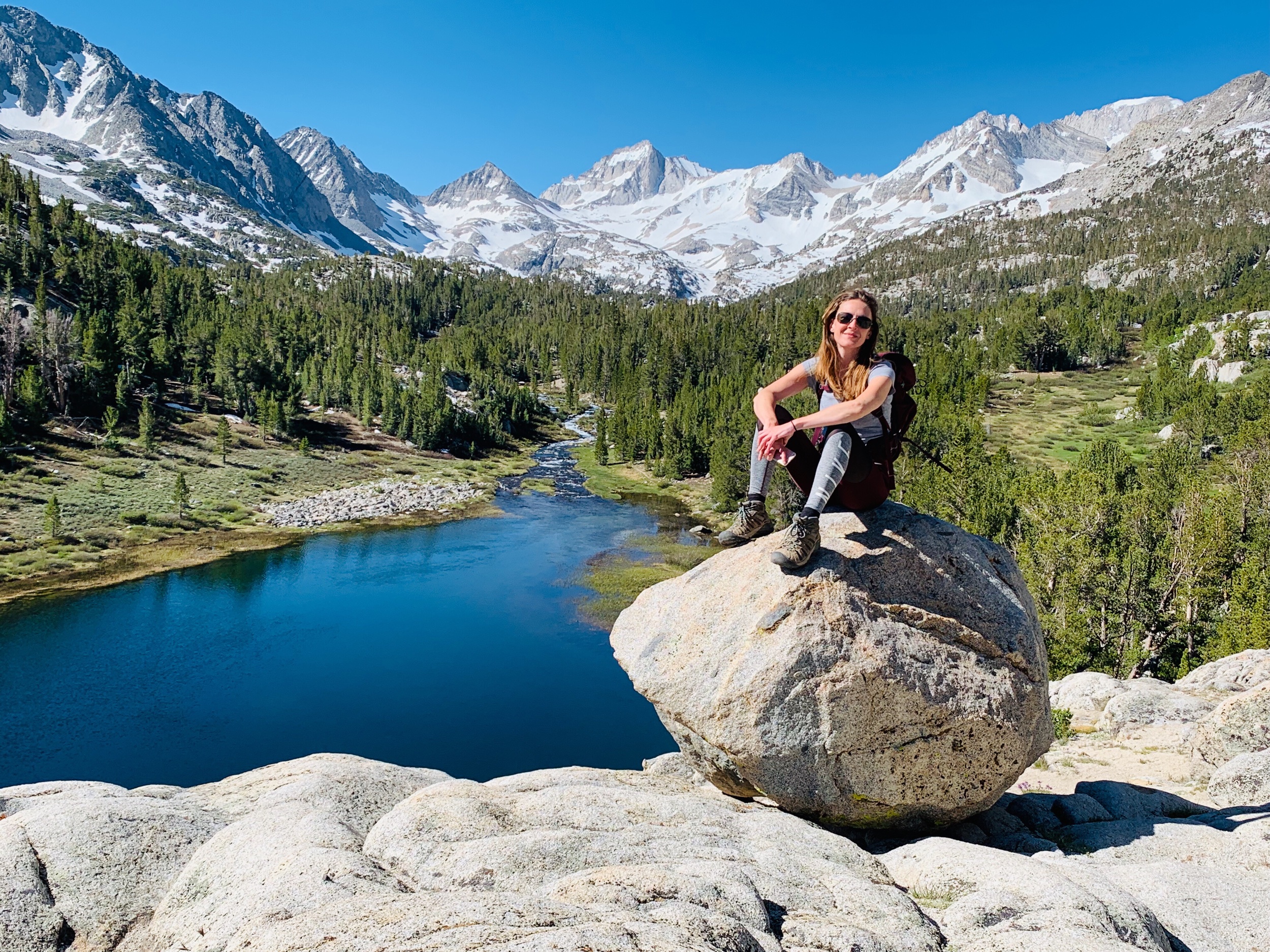


Just after the junction we arrived at Mack Lake, the first of many sapphire blue pools. We ventured slightly off the trail towards the lake and were quickly rewarded with these spectacular views! This is the perfect place to meditate, set intentions for your journey, and take some amazing photos. This first stretch of the trail is the most popular and heavily trafficked section, so we were lucky to have this peaceful sanctuary all to ourselves.
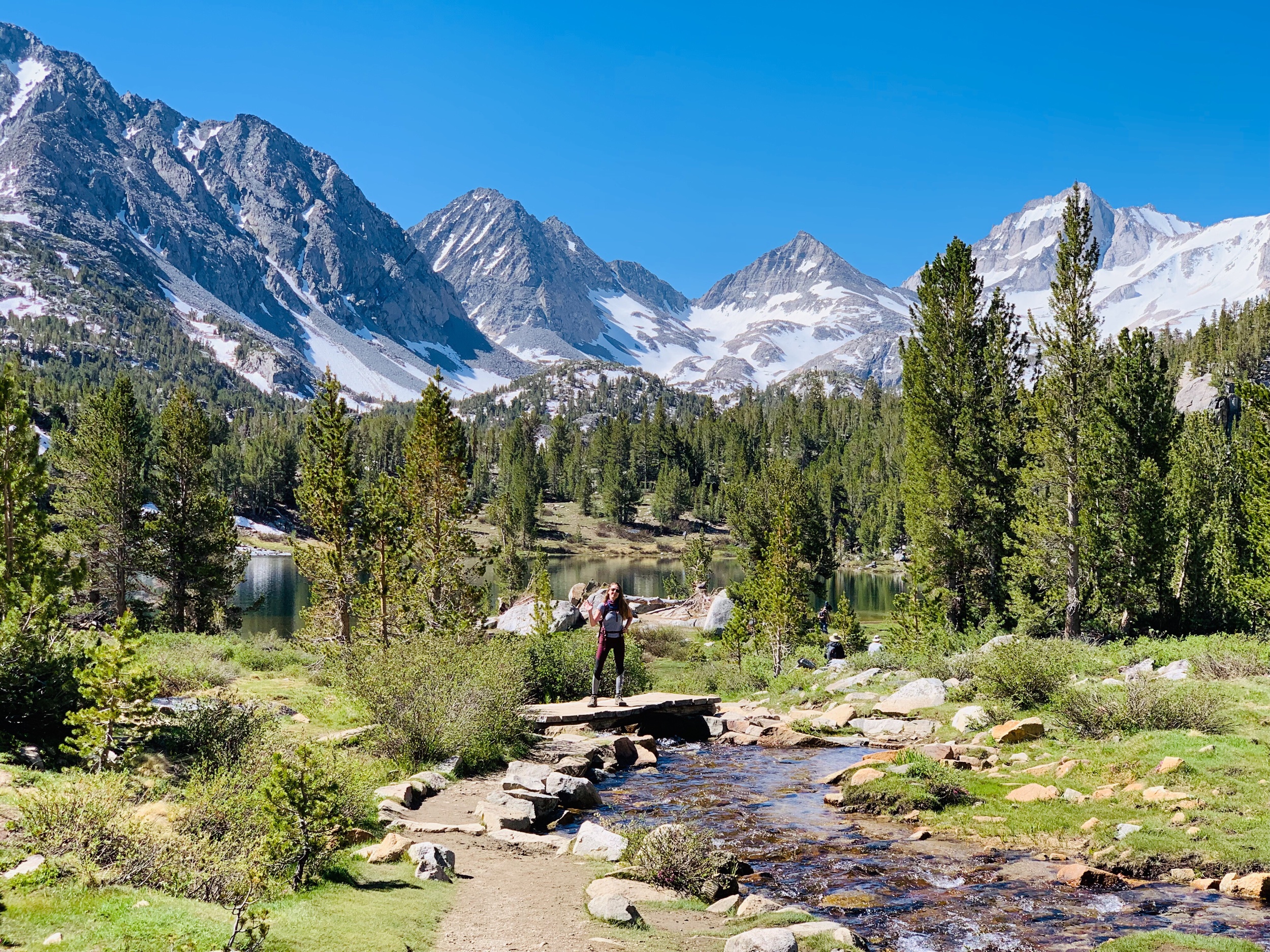
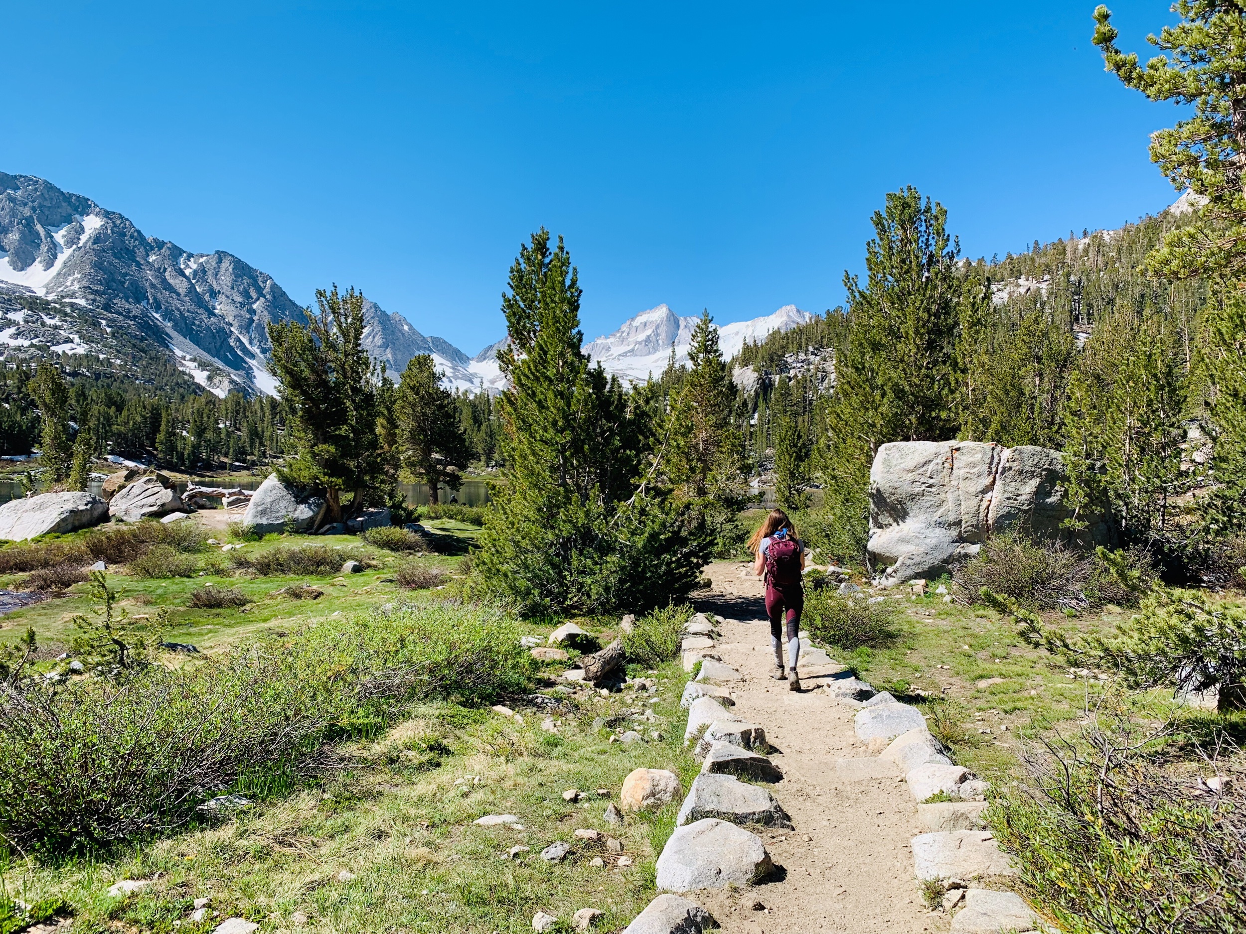

Continuing on, we followed the winding trail into the John Muir Wilderness and through meadows that greeted us with birdsongs and wildflowers. From here the melting snowcaps drain throughout the trail and some areas were patchy with water and mud. There were plenty of rocks to hop across and we were able to avoid getting our feet wet.
We soon passed Marsh Lake followed by Heart Lake where we had to cross a couple small bridges over the river. Thundering waterfalls echoed in the distance as we approached. After Heart Lake we reached Box Lake, just under 2 miles from the trailhead, where we admired the pristine waters from the rocky cliffs above.

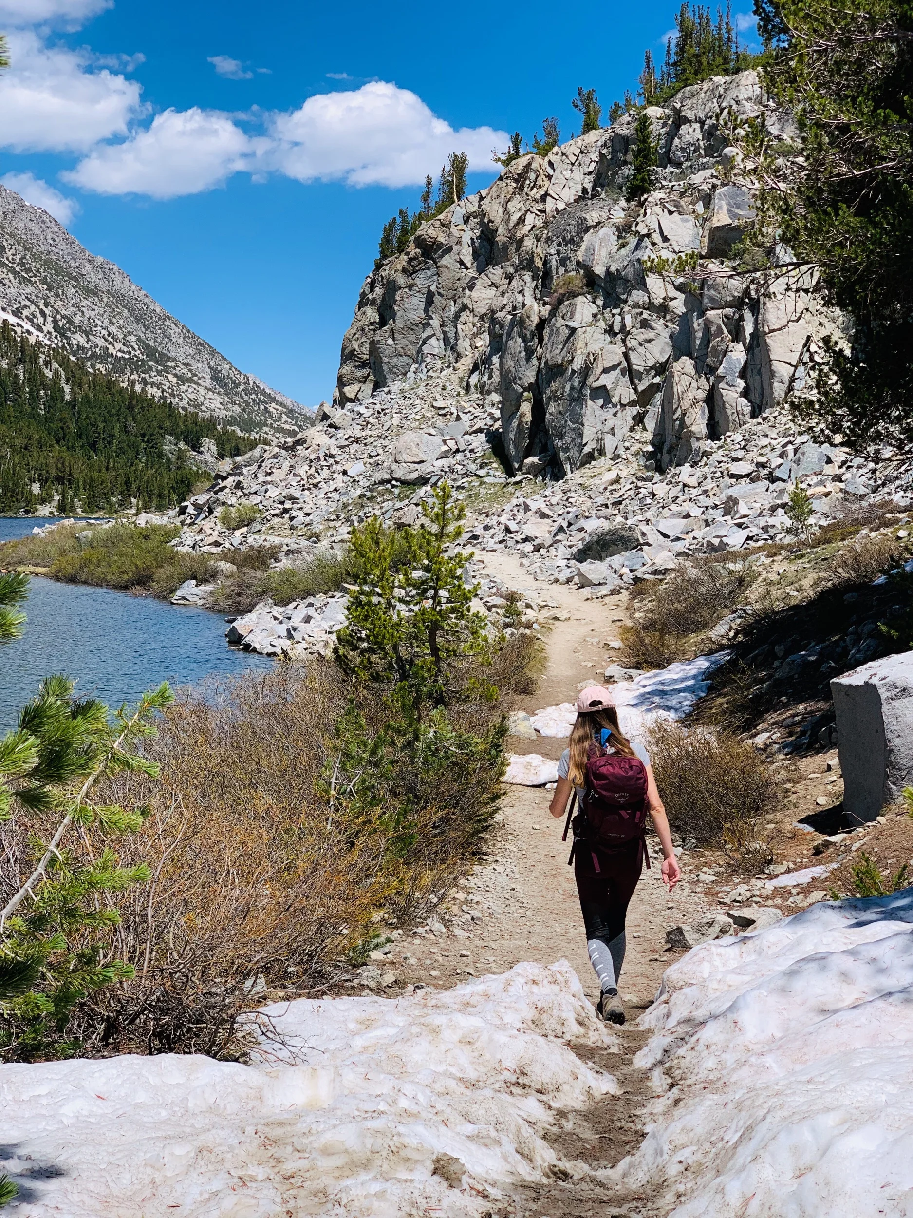
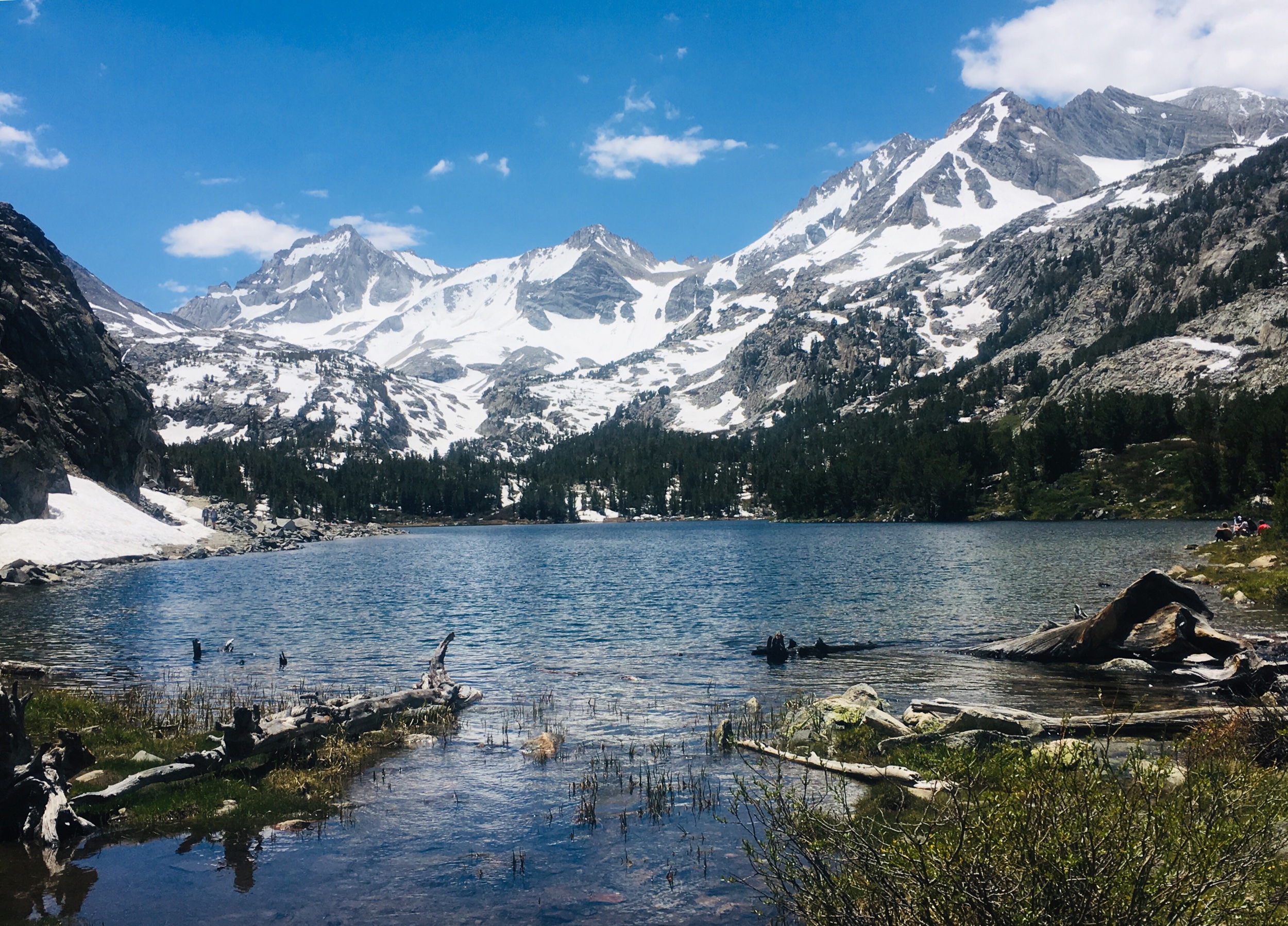
Another .5 miles further we arrived at Long Lake, one of the largest alpine lakes in the valley. As we walked up the hill, with trees perfectly framing the snowy peaks, we were faced with the river completely obstructing our path. Several families and hikers turned around here, ending their journey at the site of slight rapids and tiny waterfalls. But we were determined to continue.
Jim attempted to cross barefoot as we watched lingering patches of winter snow melting into the river. Although shallow, the water was frigid. He made it only a few steps before seizing up and running back to shore. But alas, we found a pile of downed logs and managed to stay mostly dry as we balanced across the wobbling planks.


Crossing the river was well worth the minor inconvenience to view yet another cerulean palette. The trail leads directly along the east shore of Long Lake, and had it been later in the season I most definitely would’ve dove in to cool off in the water.
The length of Long Lake is just under .5 mile and the trail from here became denser with snowfields and flowing water. We had to cross a few sections of snow which was actually pretty exciting considering it was July!


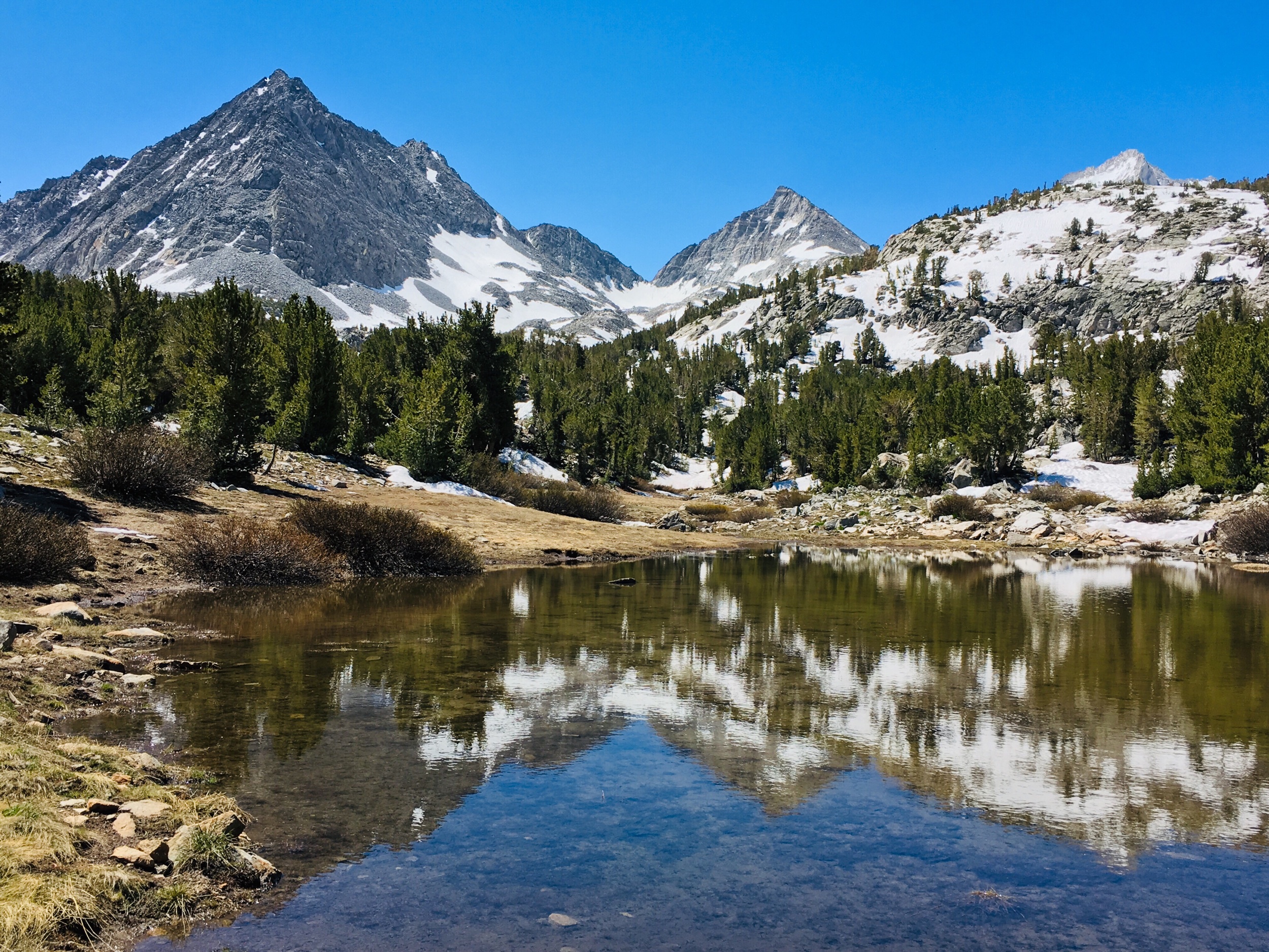
The calm waters at the south end of the lake provided a crystal clear mirror, perfectly reflecting the mountains on its surface. By this far into the hike the crowds had almost completely thinned out, allowing us to enjoy the picturesque landscape.


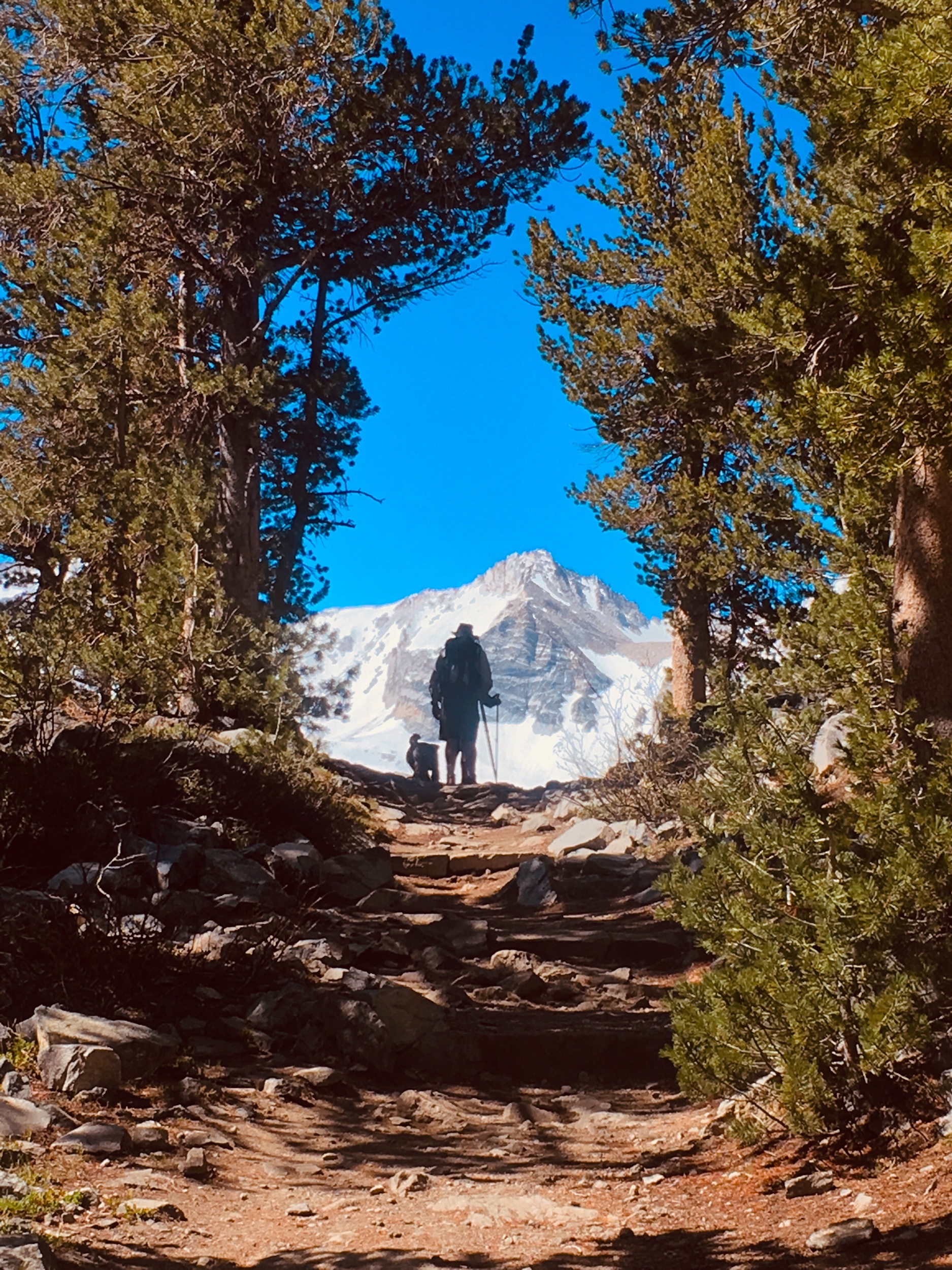
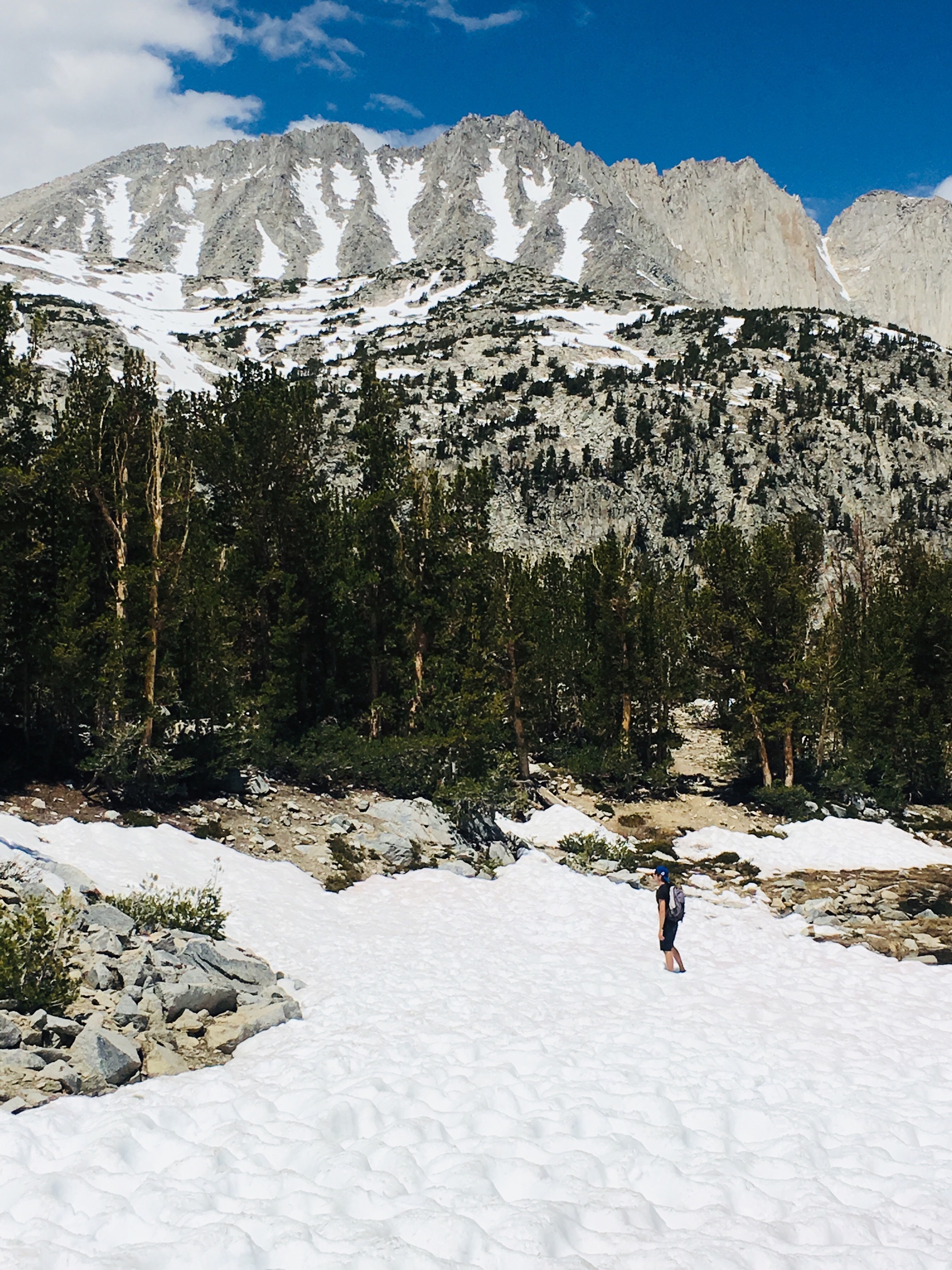
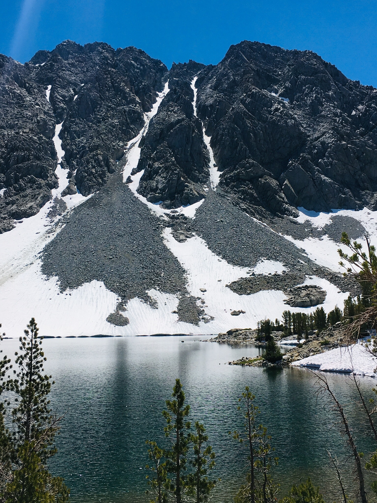
Just after Long Lake the main trail continues further to Morgan Pass. Keep an eye out for the Chicken Foot Lake sign just before reaching the 3 mile mark. At this point a small path divides off and we decided to follow the clearing toward the lake, foregoing the steeper snow-entrenched main trail. The incline increases from here and at nearly 11,000’ elevation we were feeling the burn. Without a clearly marked trail, we followed footprints in the mud for about .25 mile until we reached the snow surrounded Chicken Foot Lake.


As we made our way to the icy shore we noticed a couple tents from backpackers hidden on a rocky outcrop, but besides that we had the lake to ourselves. We enjoyed our lunch on a warm grassy knoll at the edge of the water surrounded by towering ominous peaks, and daydreamed about spending a night here under the stars.

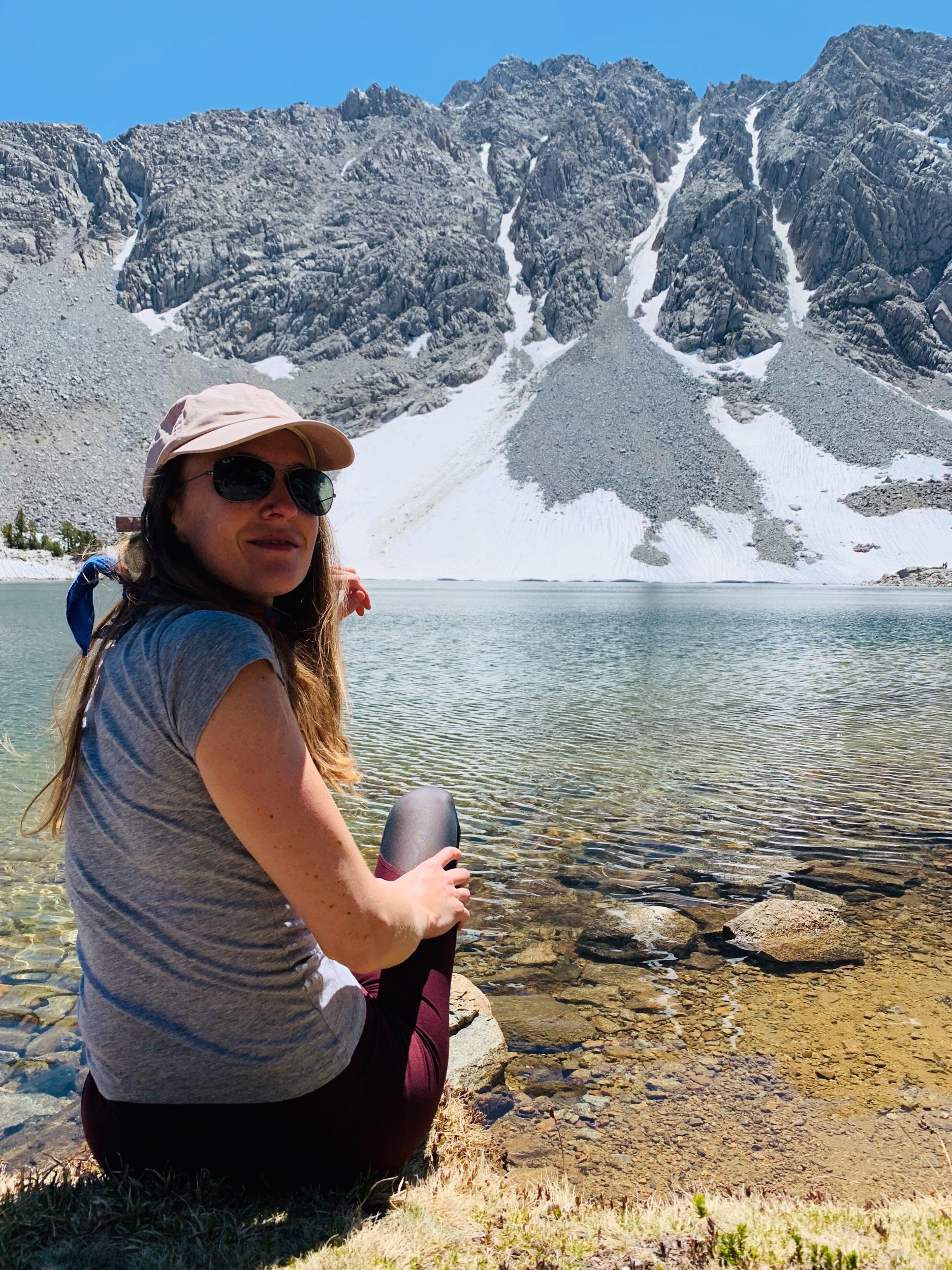
After lunch we took our time exploring the shores of the lake, climbing the rocky cliffs and sliding back down in the snow. Before long a small group of hikers arrived so we decided it was their turn to enjoy this alpine oasis. It was late into the morning anyway so we packed up and headed back to the trailhead, admiring the shifting afternoon light on our way.


As always, please leave no trace and help keep the wilderness wild! For the safety and courtesy of others please remember to carry out what you carry in, respect and sustain the natural lands, and protect this beautiful environment for everyone to enjoy.
getting to little lake valley trailhead
Just south of Crowley Lake on Highway 395, follow signs for Tom’s Place and turn west onto Rock Creek Road. Follow this for about 10 miles all the way to the parking lot at the end of the road. Make sure you have plenty of gas in your tank, you’ll ascend more than 3,000’ in 30 minutes from 395 to the trailhead.