Big Pine Lakes 2nd Lake
distance 10 miles
time 6 hours
difficulty strenuous
date august 2, 2019
trailhead elevation 7,500’
elevation gain 3,000’
notes Big pine creek campground is adjacent to the trailhead. Arrive very early for parking. restrooms are located at the trailhead
warning Swarms of mosquitos all along the creek. Bring plenty of bug spray.
The first time I saw photos of Big Pine Lakes I remember thinking, “yea right, that’s sooooo fake!” I couldn’t believe the color of these lakes were real (definitely Photoshopped) and I was even more skeptical when I learned that the trailhead is just a 4 hour drive from me. I know the Eastern Sierra are seriously incredible but this kind of place only exists in exotic foreign landscapes like Switzerland or Disney movies. Definitely not just 250 miles away from Los Angeles, right? So after doing some official Google searching and even more official Instagram stalking I realized that the colors are, in fact, very real and that I, most definitely, needed to see it for myself.
Many of my friends know this has become a slight obsession of mine over the last few years. If you’ve ever shown me the slightest interest in hiking I’ve probably mentioned Big Pine Lakes, I’ve probably even shoved my phone in your face showing you hashtagged and geotagged posts, and I’ve probably manically tried to convince you to hike this with me. To my friends that are reading this, sorry about that…
Well, I unsuccessfully attempted to go here a couple times last year. Even though it’s not that far away it’s not really all that convenient either. If you know me then you know I’m not a planner. I thrive on spontaneity and usually organize my trips last minute based on how I’m feeling. But, unfortunately, Big Pine Lakes does require some planning and the random weekends I thought I’d be able to hike it just never worked out.
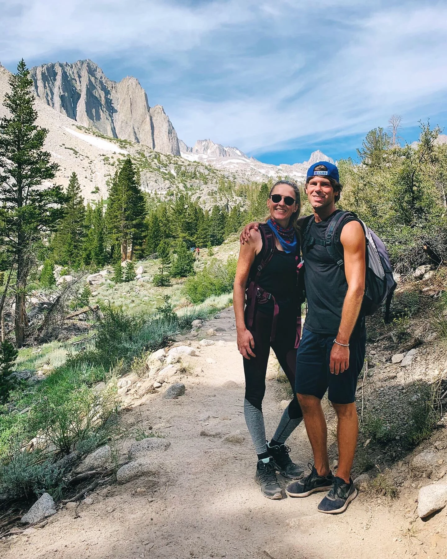
So I decided this was the year I’d accomplish my longtime goal. These lakes were turning into my mythical unicorn and this was the year I’d finally catch a glimpse. I planned it a few months out with my work—totally out of character for me—I picked the first weekend in August and took the Friday off just to make it official. Thankfully Jim was almost as excited about it as me so I was pretty stoked that we were able to go together!
If you’re planning to hike Big Pine Lakes I’d recommend spending the night nearby so you can start the trail early in the morning. Camping at Big Pine Creek campground is probably the most convenient place to stay, but you gotta make reservations well in advance and sites fill up quick. The town of Big Pine is really small and sorta in the middle of nowhere so we opted for a hotel in Bishop, about 20 minutes north of Big Pine. Bishop is a cute old-western town, Main Street is easily walkable with plenty of little shops, bars, and restaurants. Stop at Schat’s Bakery for their famous sandwiches or check out Owens Valley Distilling for some craft cocktails. Eastside Sports has all the outdoor gear you need and Looney Bean has you covered for coffee and breakfast.
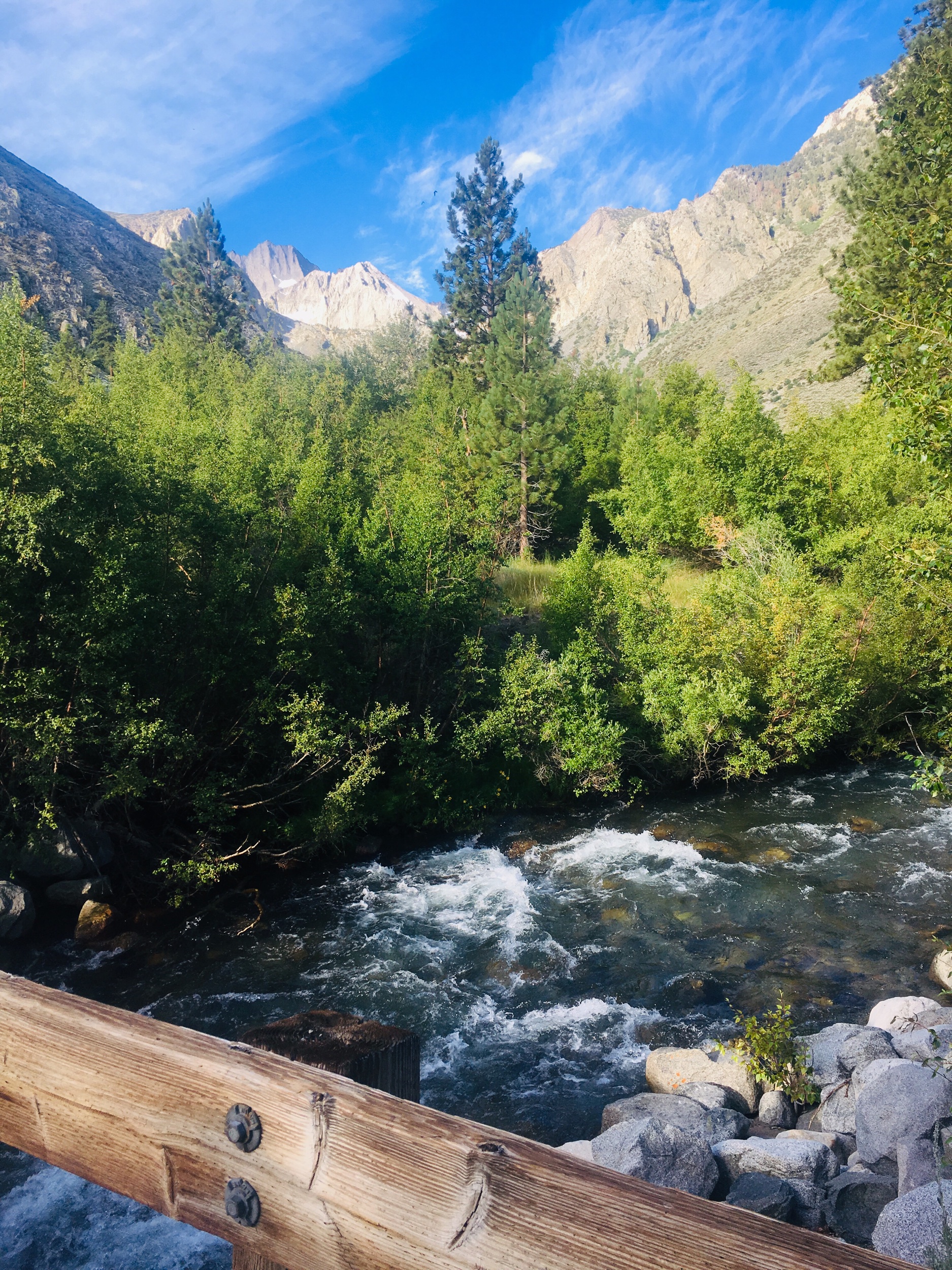
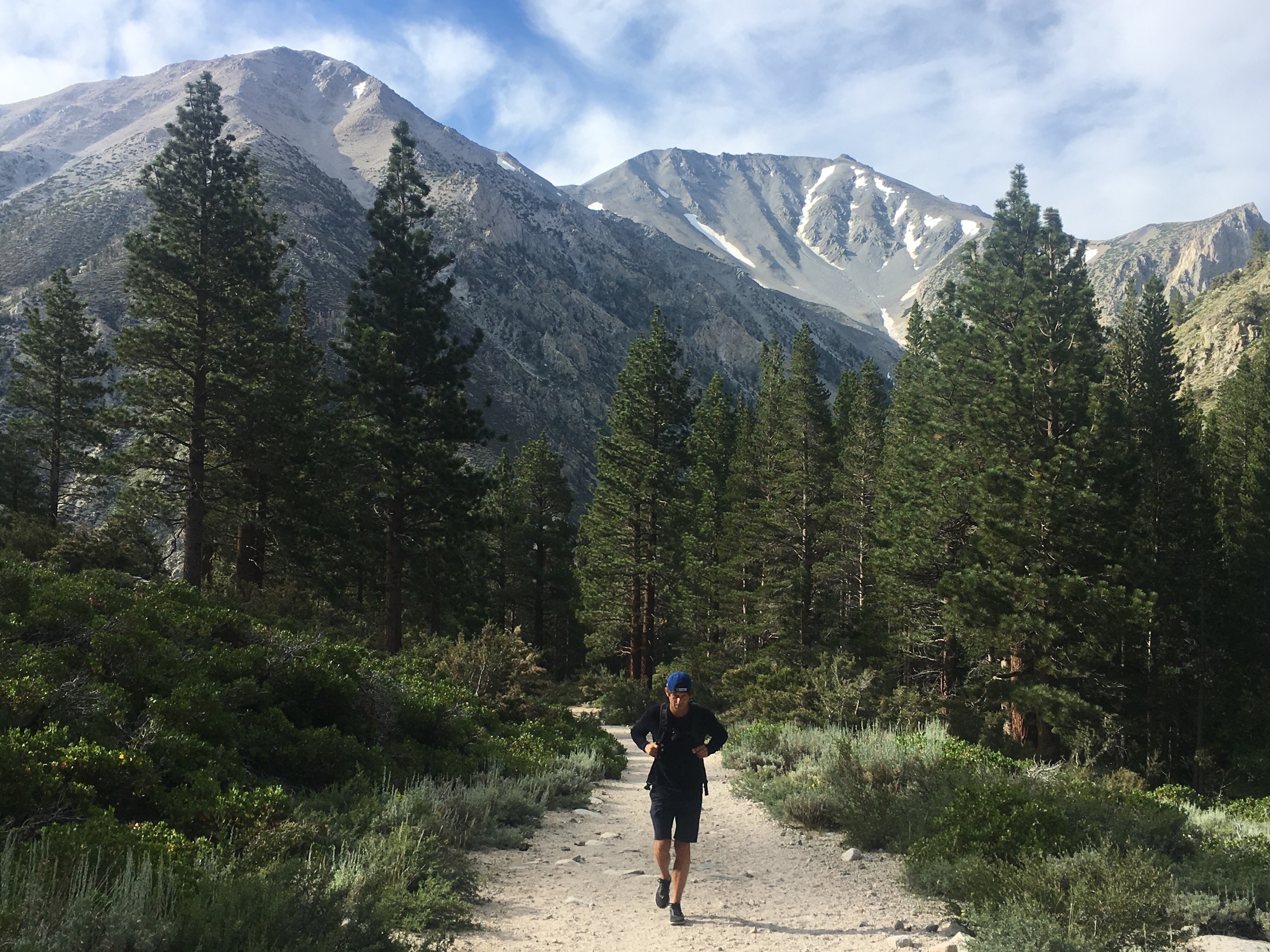
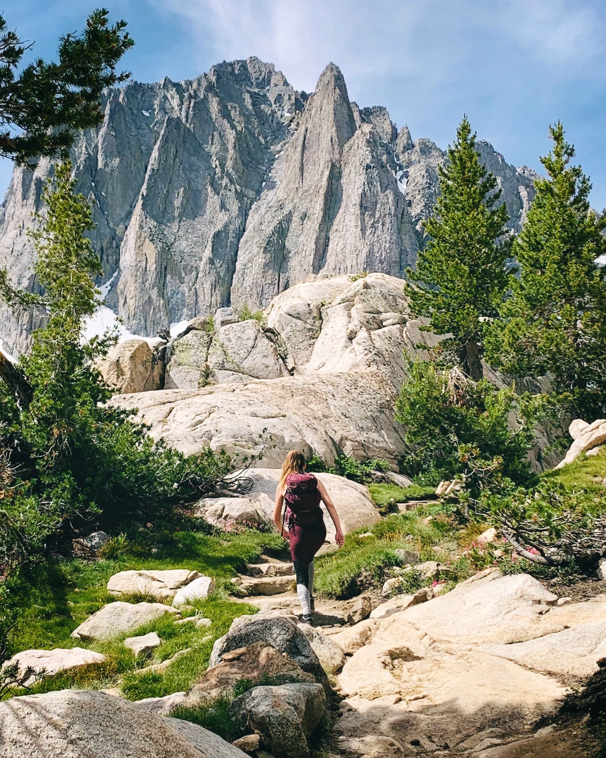
Saturday morning we arrived at the parking lot just before 8am and there were only a few spaces left. Big Pine Creek separates the lot from the campground and the mosquitos were already out in full force. We loaded up on bug spray and packed our head nets just in case. With views of the creek and high peaks right from the parking lot we were pumped to start our journey!
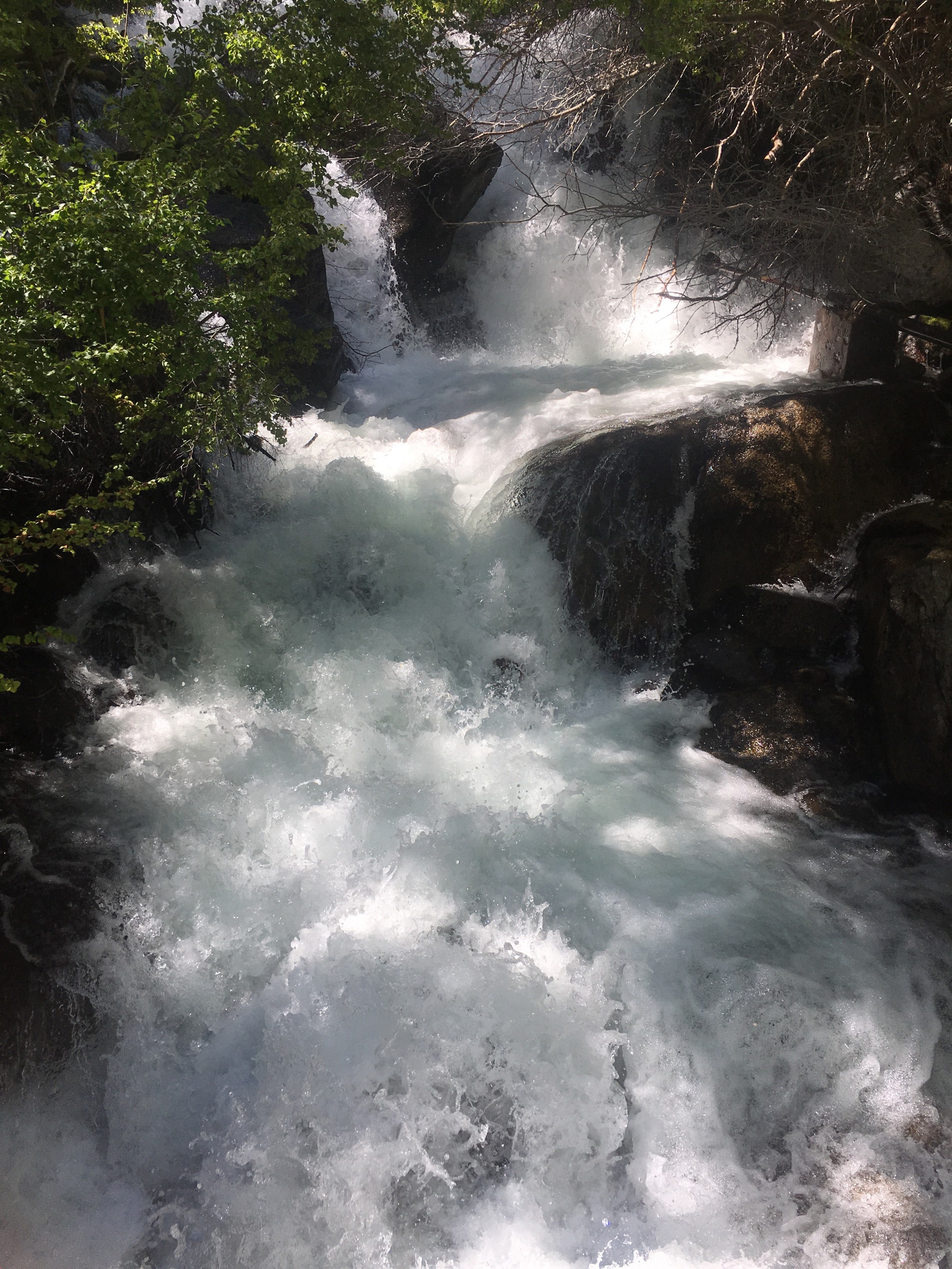
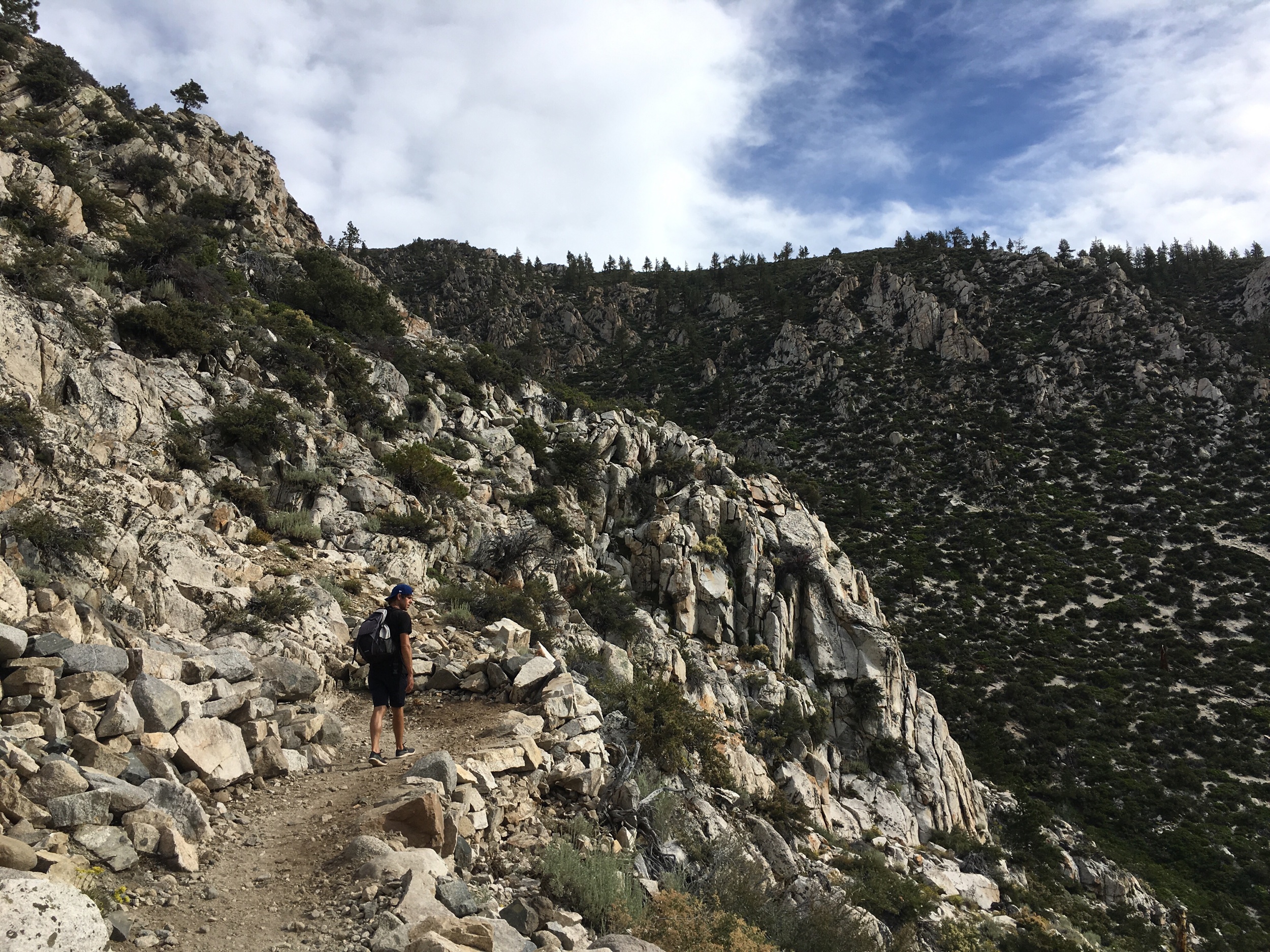
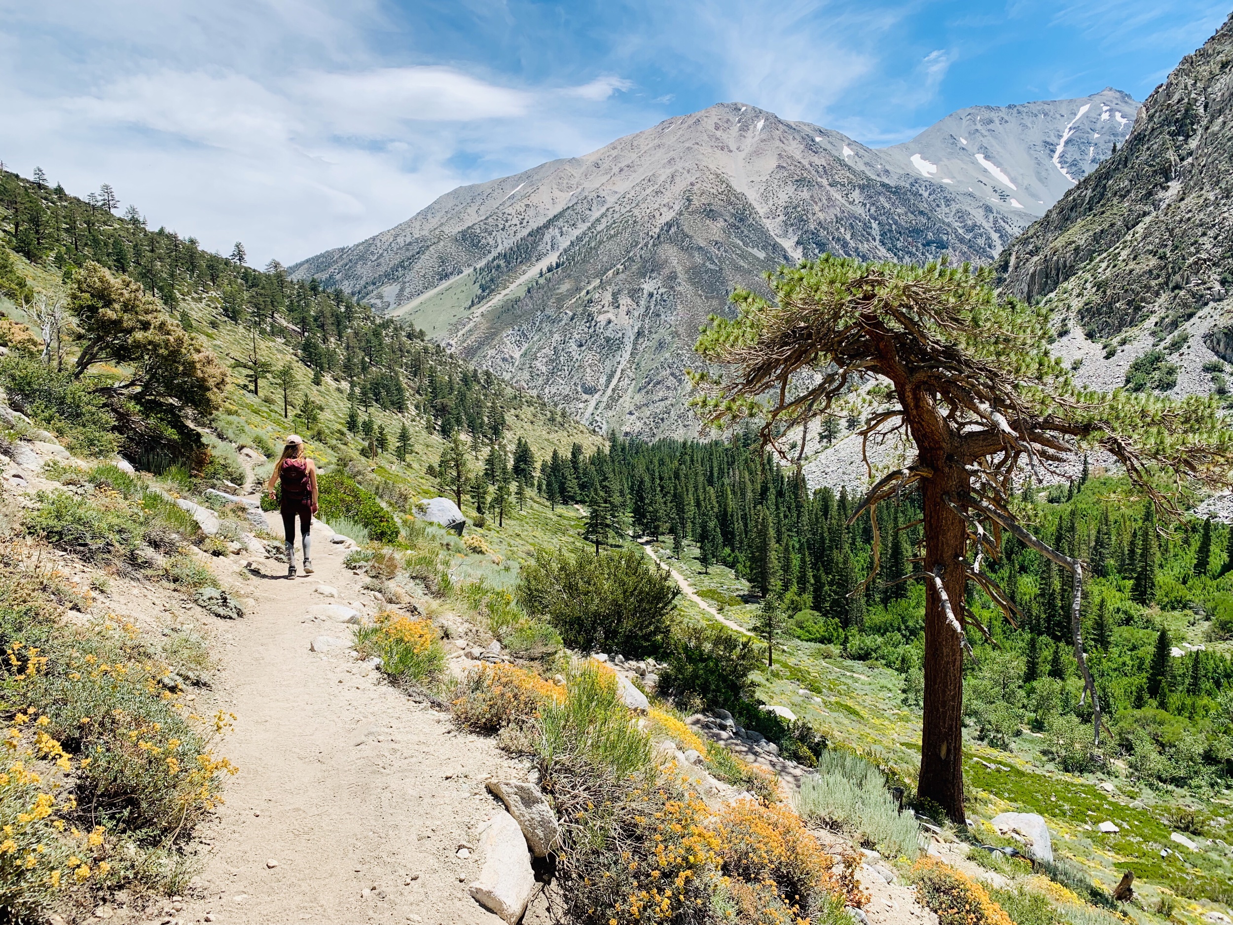
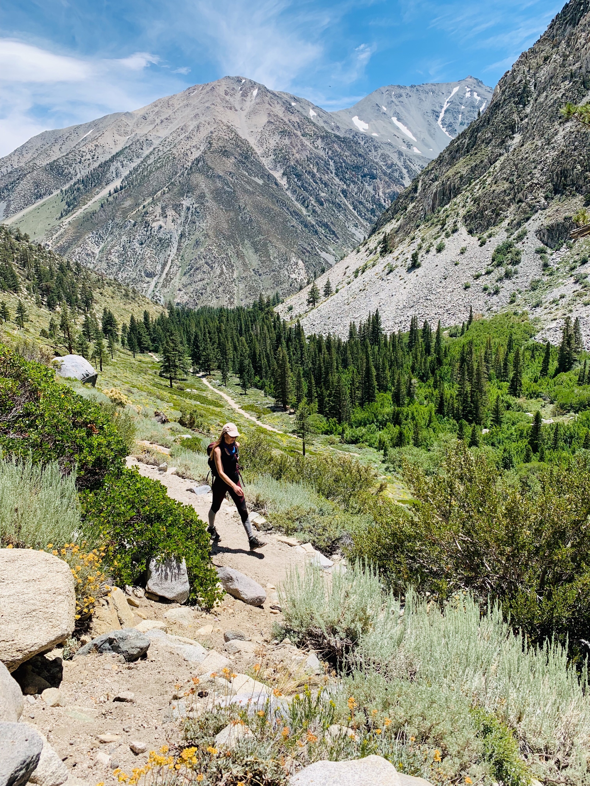
The scenic path follows along Big Pine Creek pretty much the whole way up to the lakes. Just beyond the trailhead you’ll cross a bridge over a waterfall, the first of many that are raging from all the snow melt. Keep an eye out for the South Fork (SF) junction and be sure to follow the signs to keep right towards North Fork Trail (NF). The trail winds through thick pine forests with breaks in the trees every now and again that perfectly frame the surrounding rocky peaks.
I can’t forget to mention that switchbacks hit right out of the gate and continue the entire way up to the lakes, so be prepared for a strenuous hike! I gotta admit, the first mile was pretty rough as we adjusted to the elevation and steep incline. At one point my pace slowed and Jim asked me how I was doing. I think all I managed to reply through shallow gasps for air was “heart exploding”. Ha! So we took plenty of water breaks, not only to catch our breaths but also to enjoy the incredible views.


The morning light of the Sierra feels otherworldy, almost too perfect to be real. I can’t help but think of how perfectly John Muir is able to put it into words,
“One shining morning, a landscape was displayed that after all my wanderings still appears as the most beautiful I have ever beheld… And from the eastern boundary of this vast golden flower-bed rose the mighty Sierra, miles in height, and so gloriously colored and so radiant, it seemed not clothed with light but wholly composed of it, like the wall of some celestial city...
Then it seemed to me that the Sierra should be called, not the Nevada or Snowy Range, but the Range of Light. And after ten years of wandering and wondering in the heart of it, rejoicing in its glorious floods of light, the white beams of the morning streaming through the passes, the noonday radiance on the crystal rocks, the flush of the alpenglow, and the irised spray of countless waterfalls, it still seems above all others the Range of Light.”


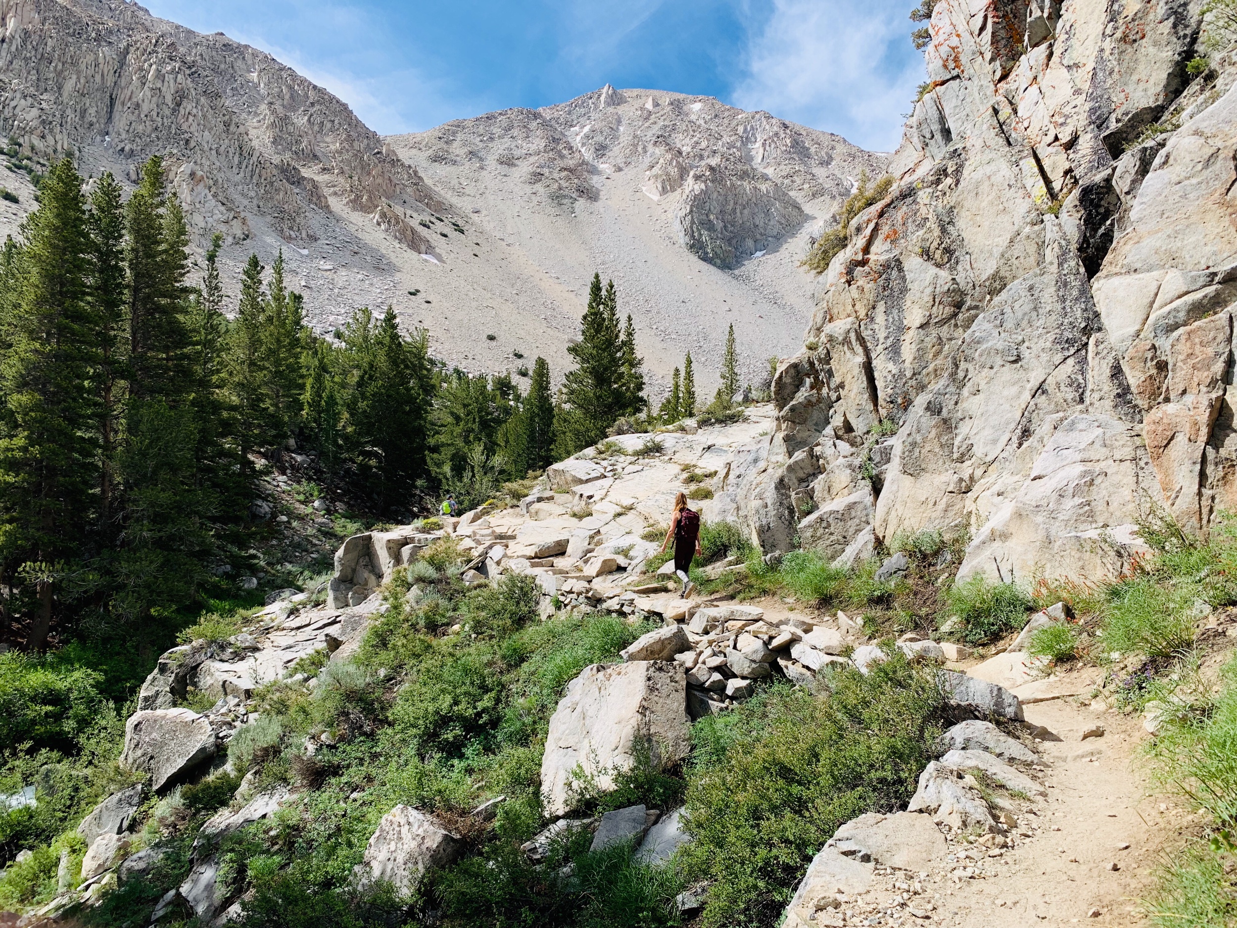
Steadily advancing in elevation, the dense pine forest opened up to a more familiar alpine landscape of granite boulders, manzanita shrubs, and sagebrush. The constant flow of the creek transitioned from soothing white noise to a deep rumble as rapids gave way to a massive waterfall high up in the distance.
When we realized that that cloud of mist was the direction we were heading, we were standing directly in front of the most gnarly rock wall criss-crossed with dozens of narrow switchbacks. Teeny tiny moving specks of color were sprinkled along the cliffside, and when we focused close enough we noticed they were actually hikers trekking their way up. We felt intimidated for sure, and knowing that we had a couple more hours of elevation gain ahead of us I can say with confidence that this was one of the most challenging hikes we’ve done yet. But we knew the payoff was worth more than the physical stress, and the buzz of anticipation kept us fueled.

As we ascended higher into the sky on this rocky staircase, the sun followed right beside us. The crisp mountain air quickly increased in temperature on the fully exposed ridge. But at the end of every other switchback the creek offered us a refreshing reprieve from the heat. The water, by now, was an echoing roar of raging rapids, like a freight train tearing through the pass, cooling us off with its glacial spray.


After about an hour of climbing this rugged terrain we finally finished the seemingly endless set of switchbacks and were about 2/3 of the way to our destination. Now we were at over 9,000’ elevation and the creek led us through a peaceful Aspen grove. I’d love to come back here in the Autumn, when the leaves transform into shimmering gold medallions. We passed a boarded up Ranger cabin and I wondered what a privilege (and responsibility) it must be like to live deep in this wilderness.
Soon the forest gave way to yet another set of defeating switchbacks, but we were rewarded with our first glimpse of Temple Crag towering in the distance. Our tired legs and dwindling motivation were quickly restored by the sight.
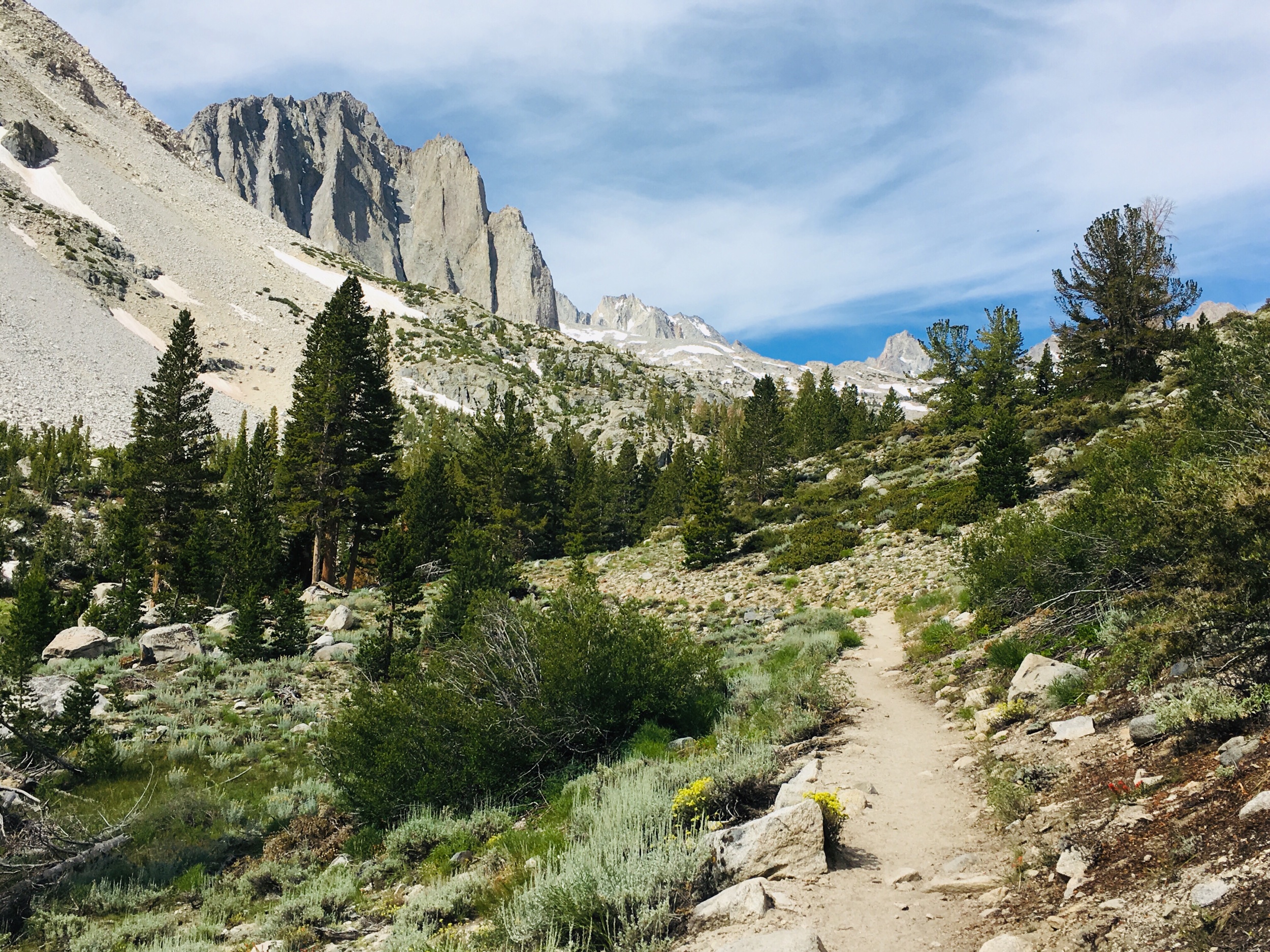
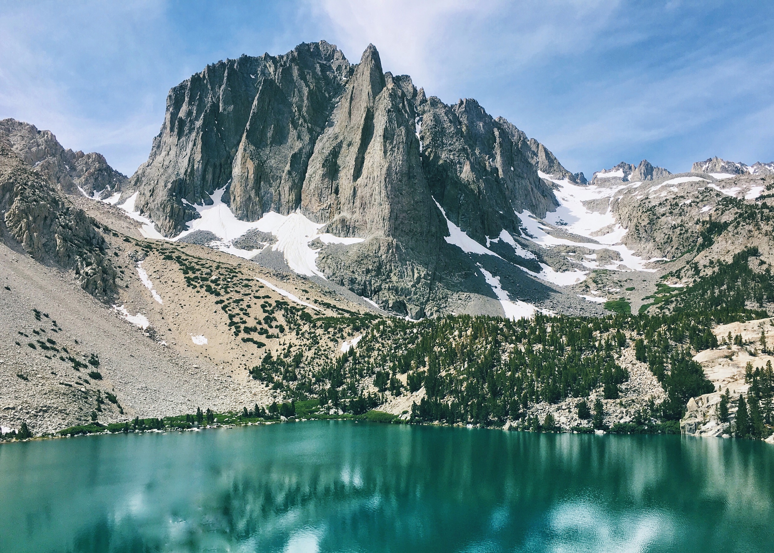
As we made our final ascent we passed a woman who must’ve recognized the anticipation on our faces and she assured us that the lakes were just up ahead. The encouragement was welcomed and as we picked up our pace to round the corner, sure enough, there was 1st Lake. Between the granite boulders and scattered brush was the striking glow of the milky aqua pool. It looked as if someone took control of real-life Contrast and Saturation sliders and cranked them all the way up. But 1st Lake is tucked away with only a small open viewing area, so we continued another 10 minutes ahead to our destination at 2nd Lake.
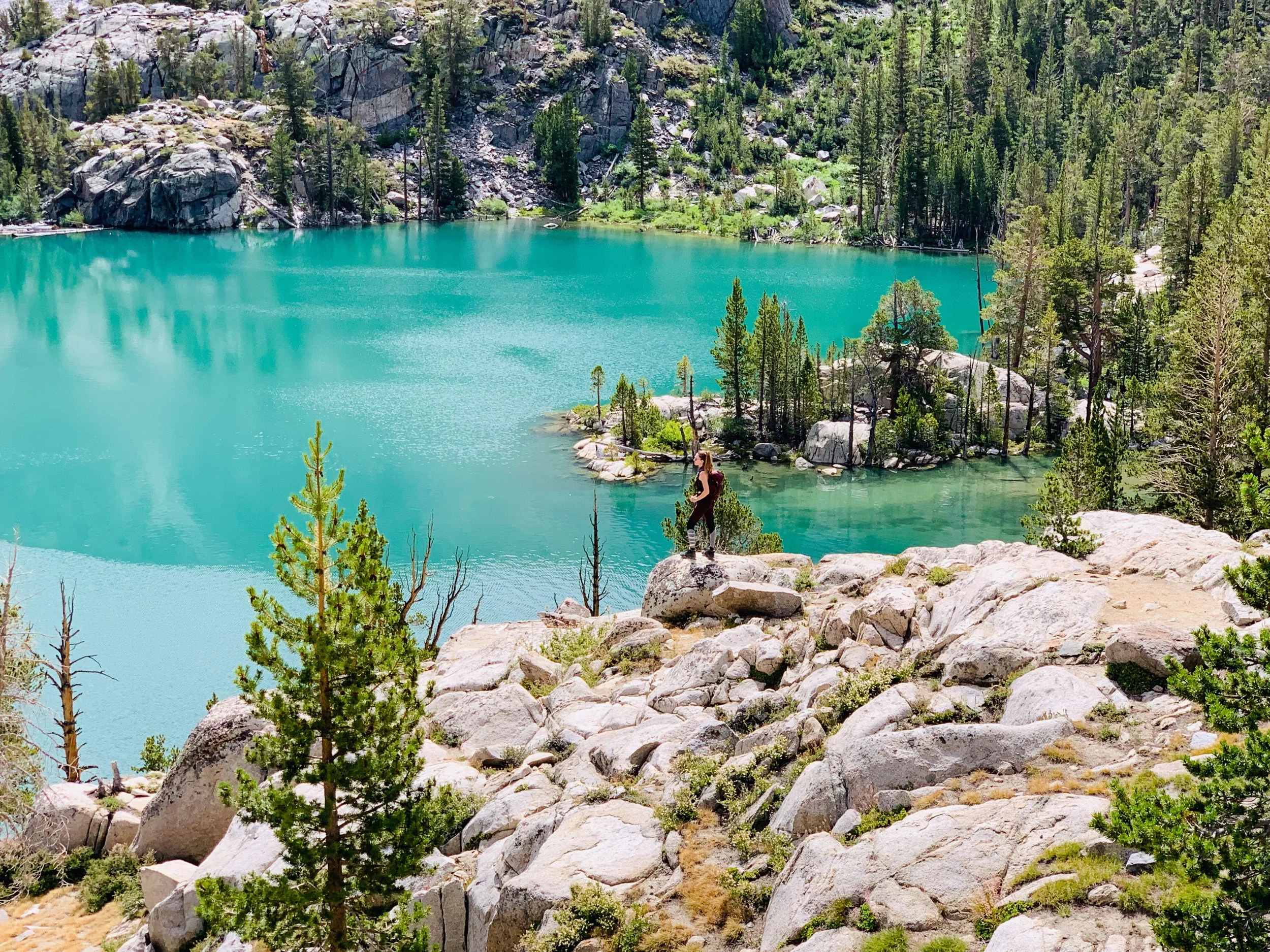
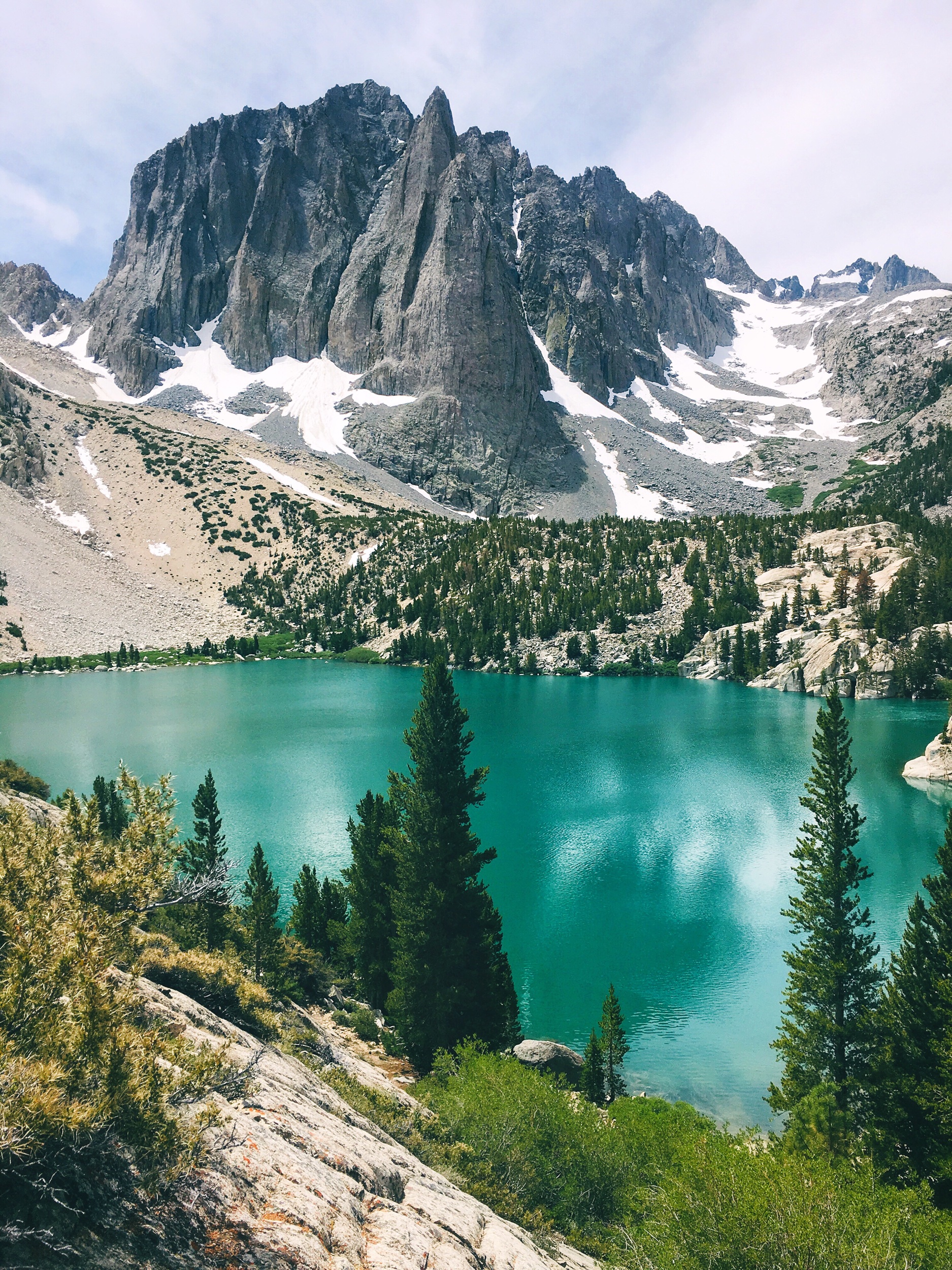

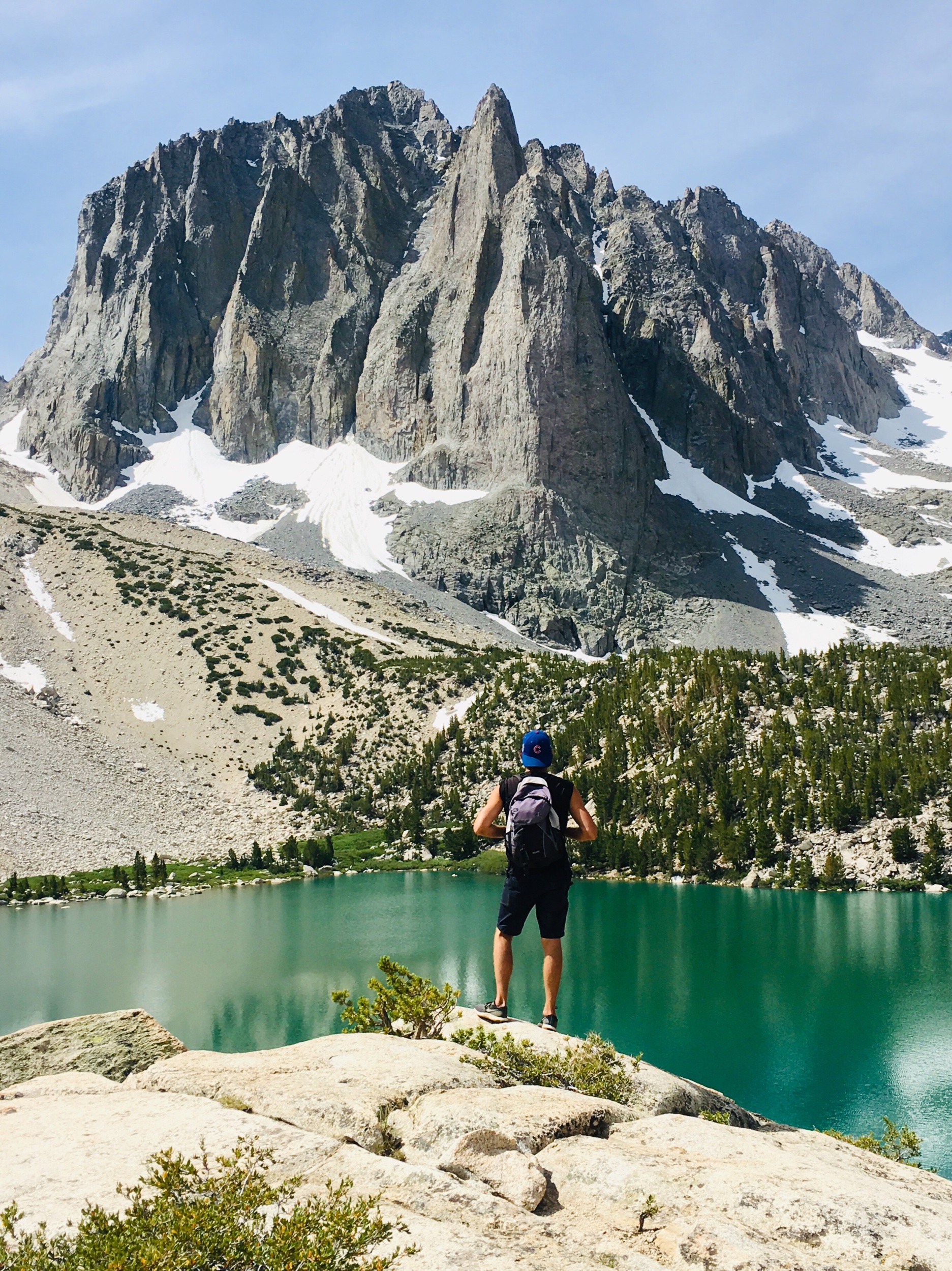
And there it was. After years of wondering if this place was really real, or if all the Google and Instagram photos were just one giant Photoshop conspiracy, I stood before the monumental Temple Crag and gazed down at the iconic glacial lake hundreds of feet below. I finally achieved my goal of conquering this epic slice of the Sierra!


We wandered around at the top for a bit before deciding to climb down for a lakeside lunch. Another group of hikers were nearby, jumping off the rocks into the frigid water. We put our toes in to cool off, but there was NO way we were going to dive into this glacial runoff! Next time I need to bring a floaty pool raft! Eventually the cliff-jumpers packed up so we were left to enjoy our solitude. We relaxed for a while and reflected on our day of accomplishment.
Tents and campsites were scattered throughout, hidden among the coves and displayed on the rocky outcrops. This must be such a dreamy place to admire the alpenglow on the peaks as the sun sets and then rises again in the morning. And I can only imagine what the sky looks like at night under the Milky Way. Next year I’ll be back, but I’ll have my gear with me for an overnight stay. There are 5 more lakes to see in the Big Pine Lakes loop and you can even hike up to Palisade Glacier. Who’s coming with me?? Leave some love in the comments below!


Oh and one more thing I want to share is this NekTeck portable solar panel charger that Jim brought. It’s lightweight and super convenient, we left it exposed on a sunny rock and it charged up both of our phones. Between all the photos we take and using apps to track our distance, elevation, etc we always run out of juice fast and our batteries usually die before we get back to the car. This solar pack is a game changer!
And here’s a few more photos of our hike back down the ridge of switchbacks. The afternoon light seemed to add an extra spark to the colors of the landscape.


As always, please leave no trace and help keep the wilderness wild! For the safety and courtesy of others please remember to carry out what you carry in, respect and sustain the natural lands, and protect this beautiful environment for everyone to enjoy.
getting to big pine creek trailhead
In the town of Big Pine on Highway 395, just south of the Bristlecone Pine Information Center, turn west onto W Crocker Ave. This is a side road that runs through a small neighborhood but it becomes Glacier Lodge Road after you drive past the homes. Continue for about 10.5 miles all the way to the Trailhead at the end of the road. There are a couple of day-lots and on street parking near the Trailhead. You’ll gain quite a bit of elevation on Glacier Lodge Road so make sure you have plenty of gas in your tank.